World Masters Orienteering Championships – Sestriere – Italy – July 2013 – Day 5 Long Final

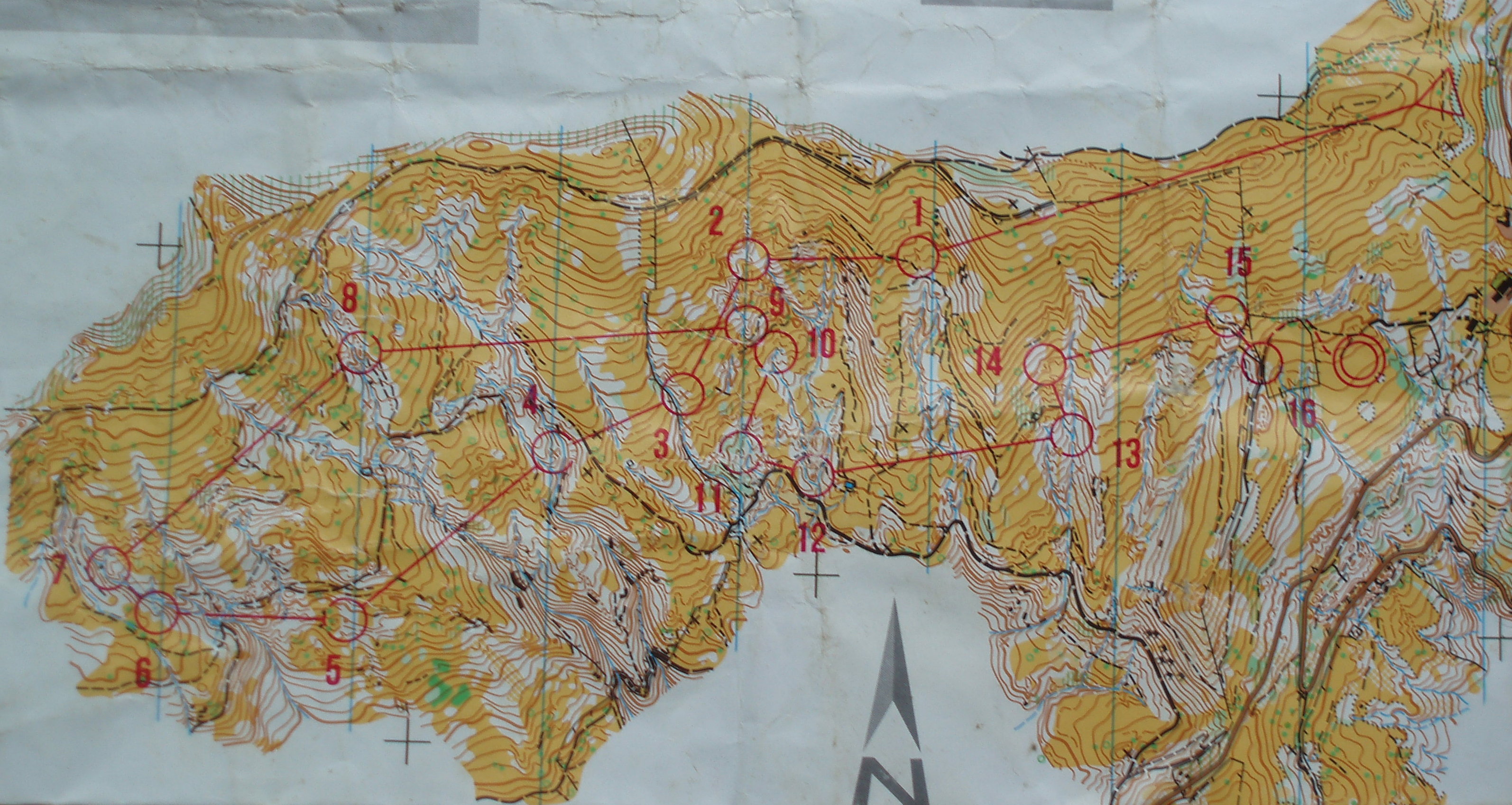
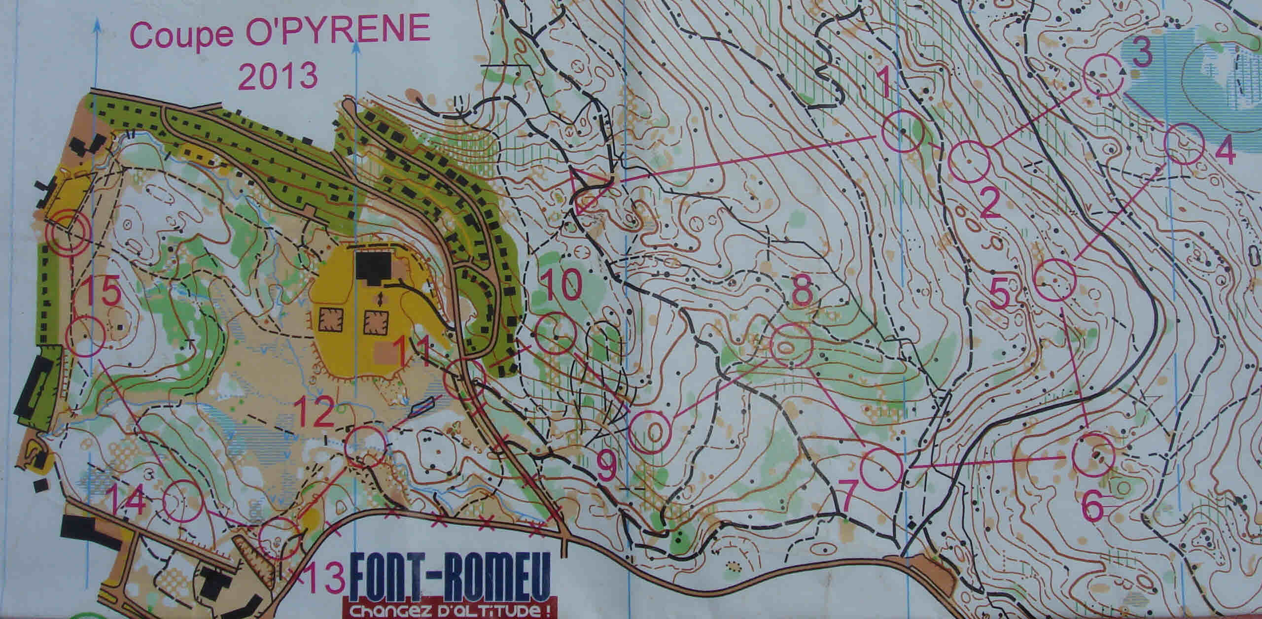
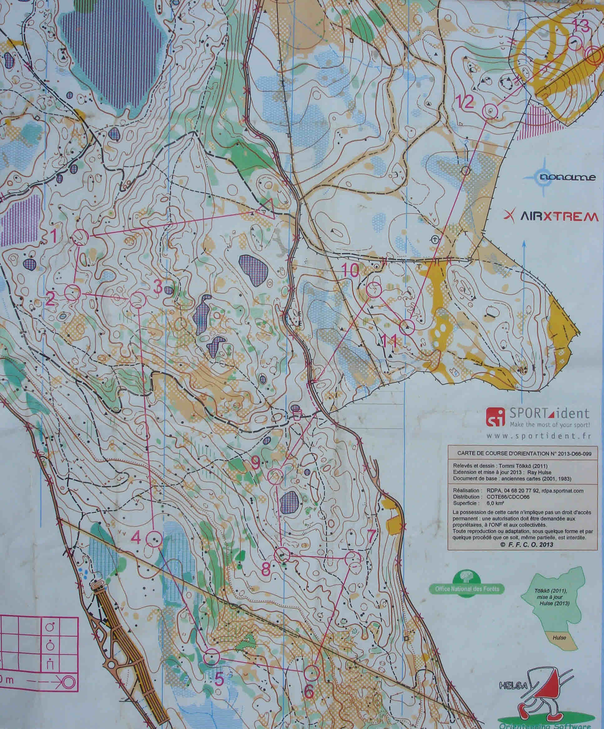
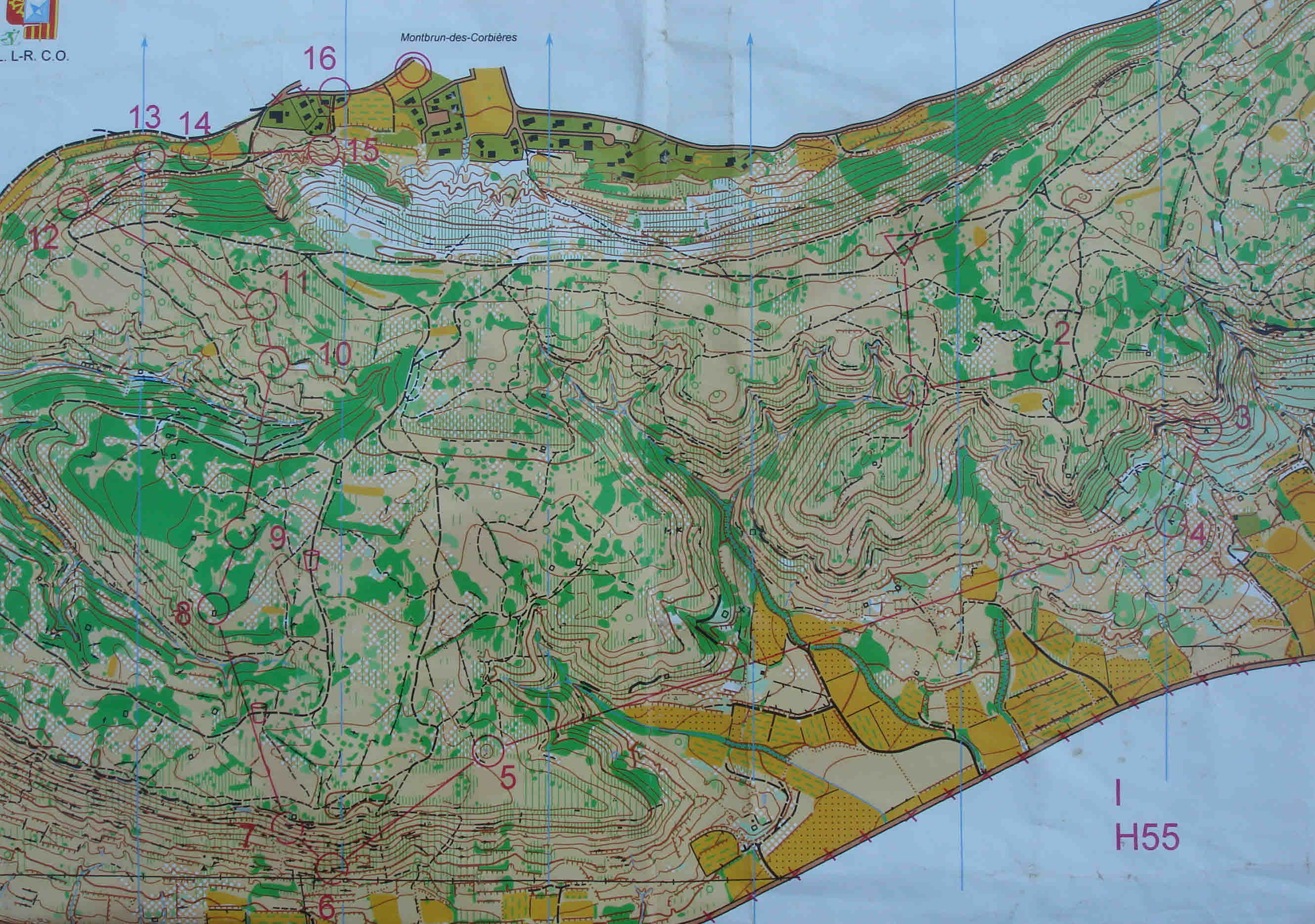
Long Final – Monte della Luna – 6.6kms; 340m climb; 20 controls.

DSC07000

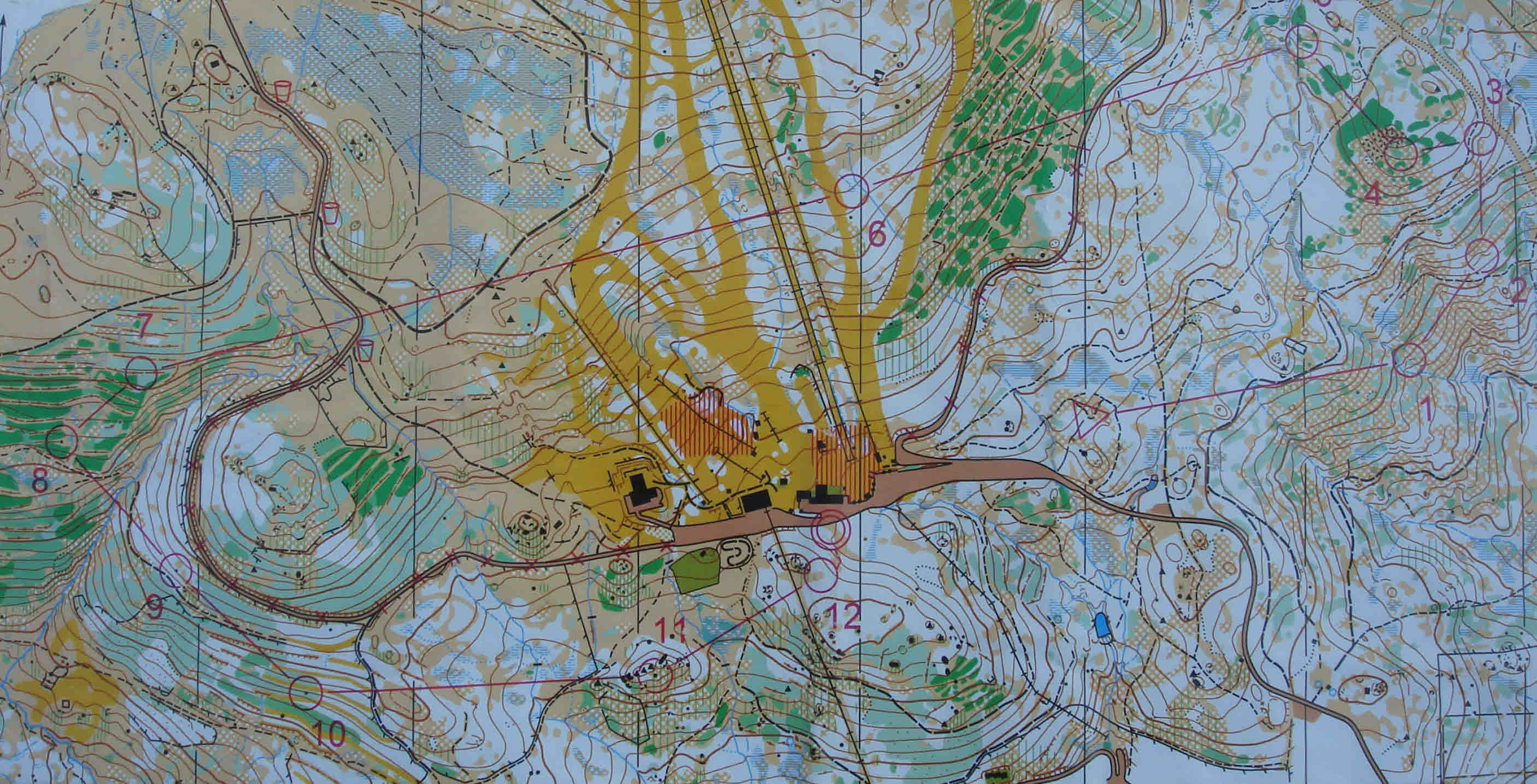
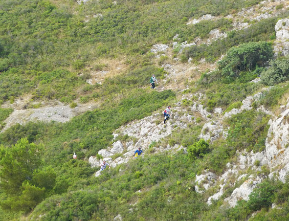
The bowl shaped arena area can be seen in the lower centre left with ski slopes running into it

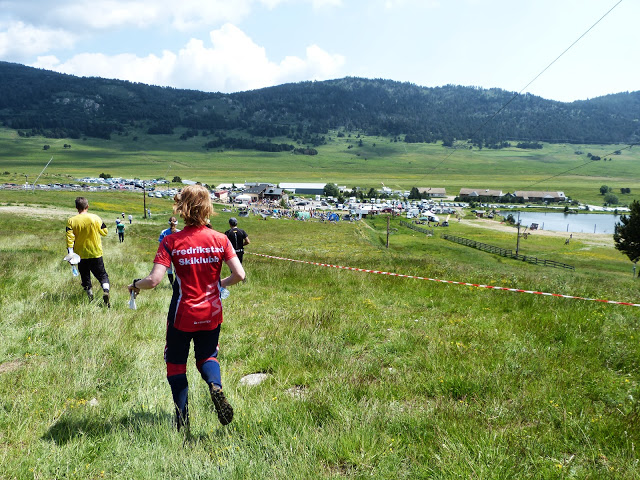
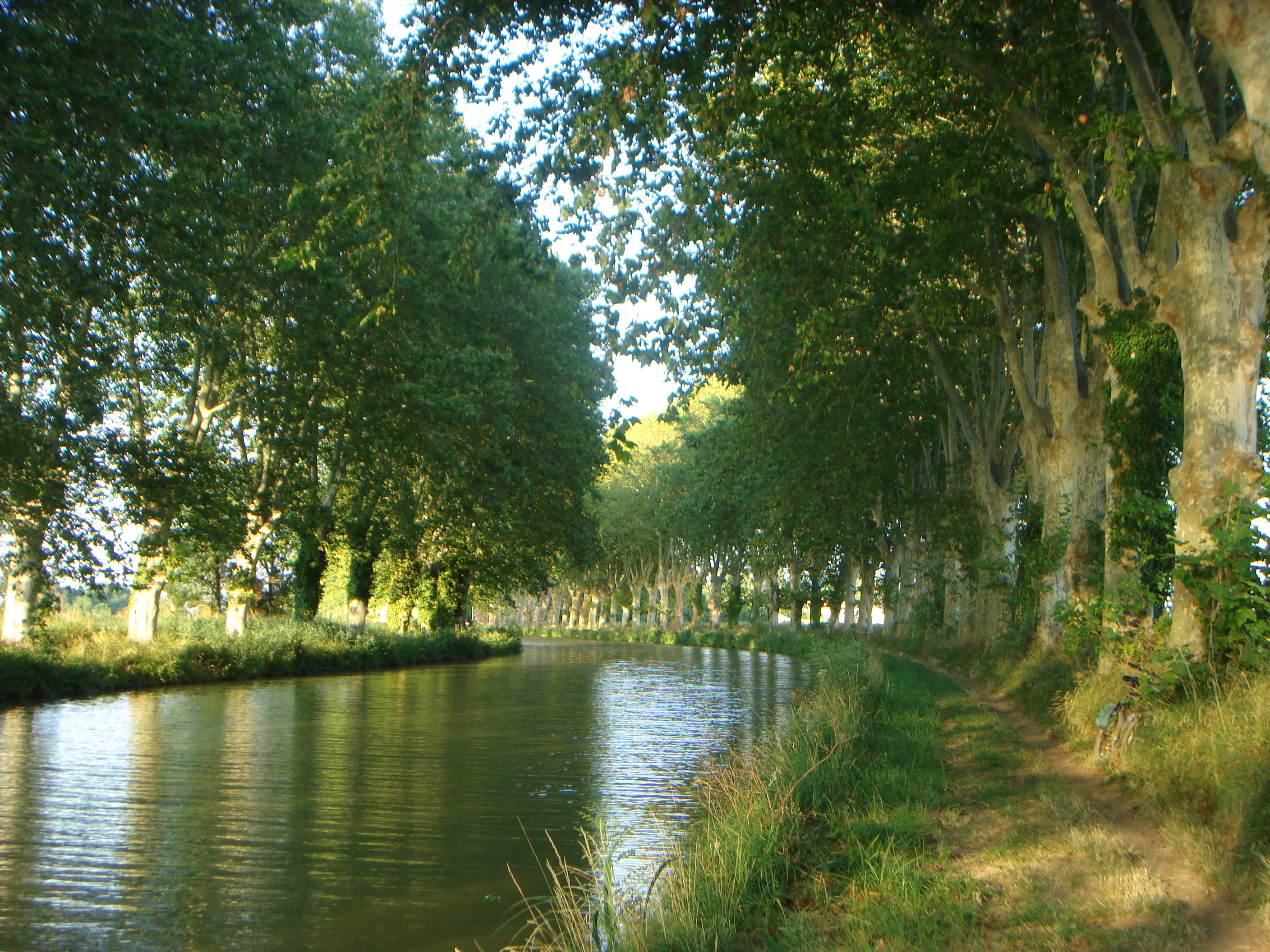
What a fantastic name for the Long Final venue. And a wonderful arena too at Sanga Longa at more than 2000m in a natural bowl with a small lake, typical alpine scenery, wonderful views and only accessible by chairlift from Cesana.

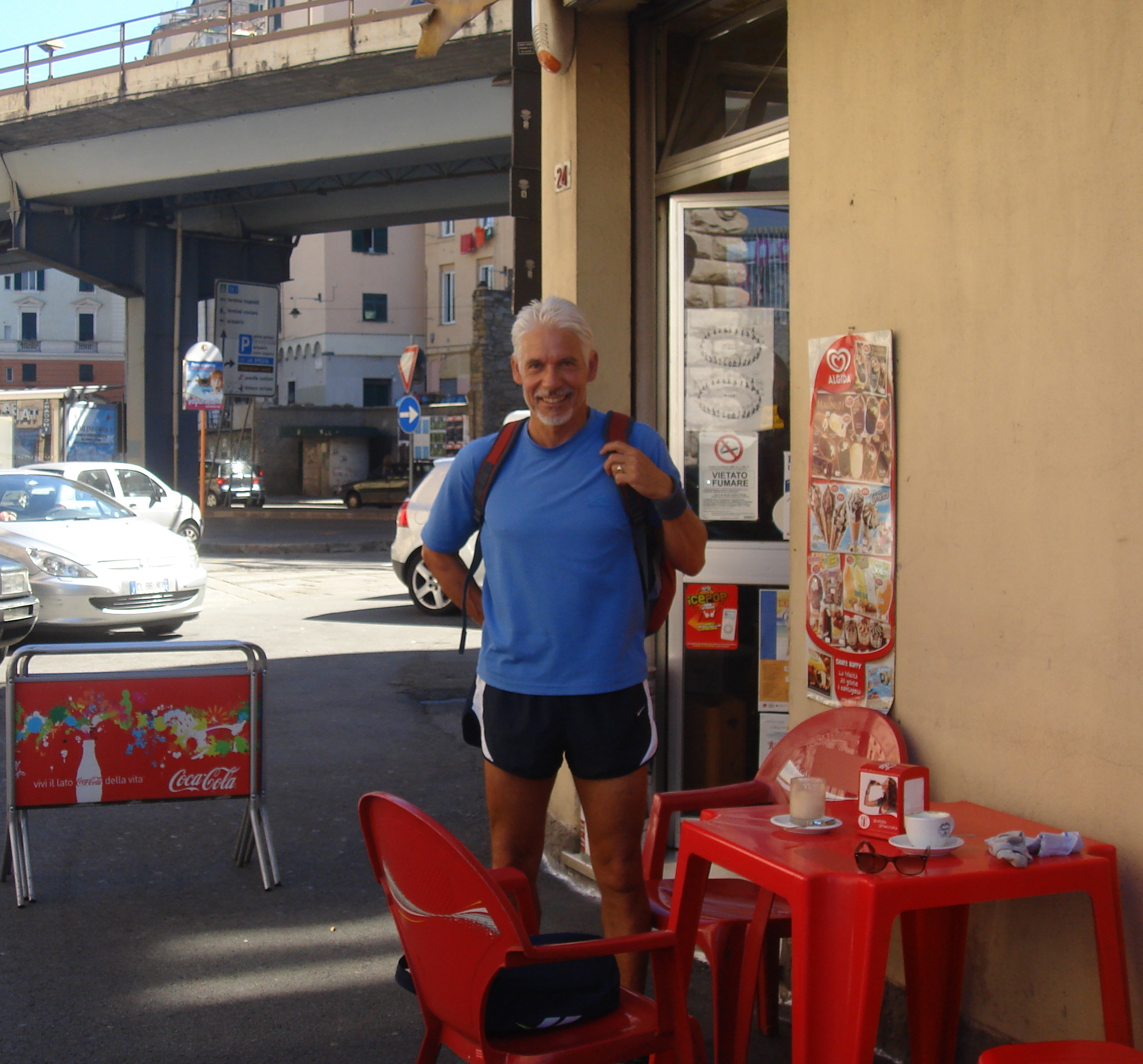
Having qualified for the A Final I had a reasonably late start, but we were instructed to be at the bottom of the chairlift at least two and a half hours before our start time. It had the makings of another administrative disaster but for us it was fine – though I did hear of some earlier commotion.

DSC06863

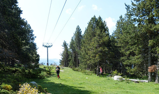
Final approach to the arena by chairlift

I have to say I much preferred this terrain to that of the two qualification races. We actually had more climb overall, but the hills didn’t seem so steep and there was a lot more variety.

Fortunately my first control was relatively easy so I quickly settled into the map and terrain and managed to plan, chose a route  and execute it well and at pace through to #5. Not sure if my contour hugging S shaped route to #6 was the best when running on the side of the steeper slope but found the control ok.

OLYMPUS DIGITAL CAMERA
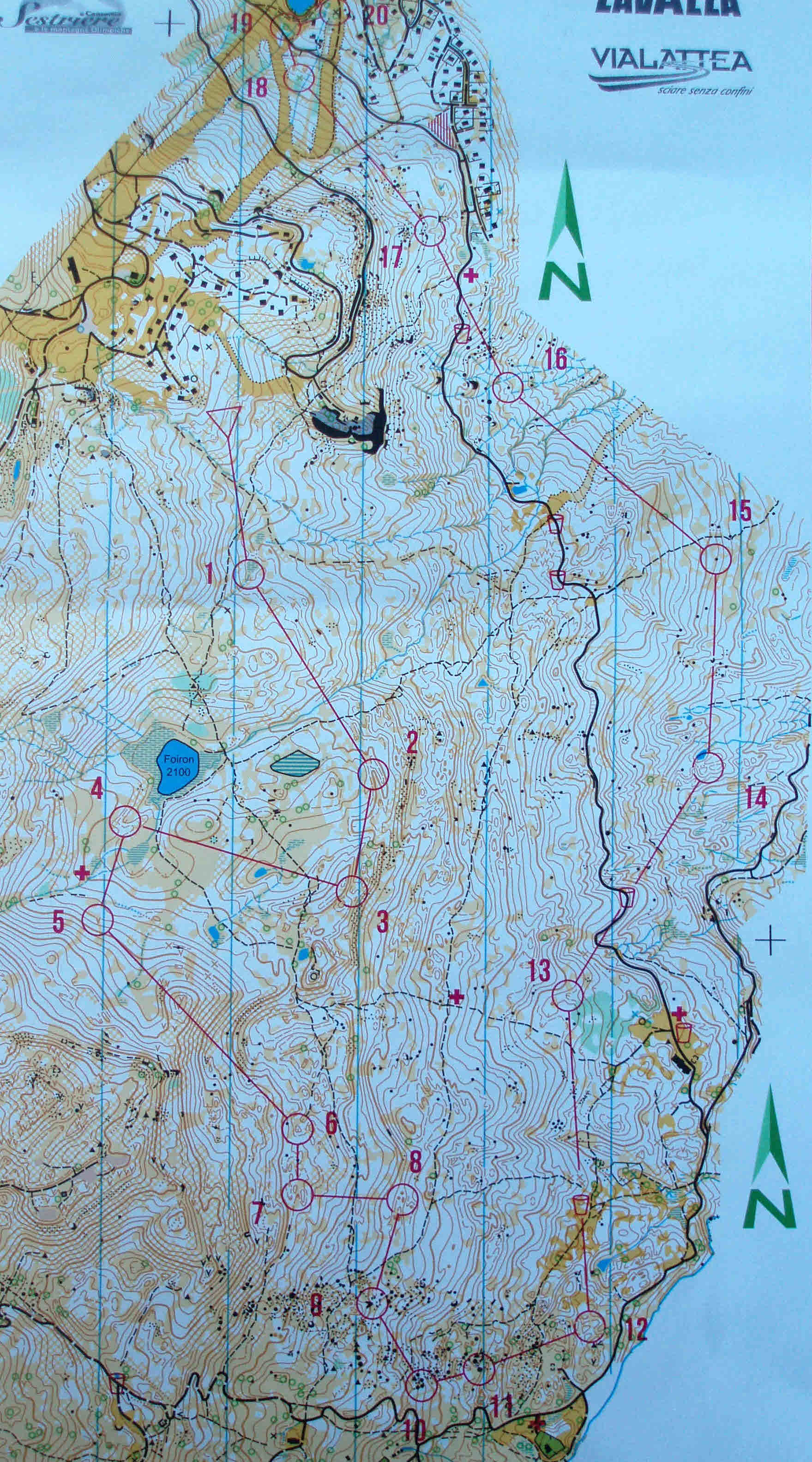
I really enjoyed the more stony terrain through #8 to #12 and was able to keep up a very good pace nimbly jumping and skipping through the rocks and still being accurate. I was gaining in confidence and ran as fast as I could on the path towards #13 overtaking a few slower competitors and not stopping at the water point.

It turns out I was 10th overall at this point. Was I becoming over confident perhaps? as I then promptly made errors approaching the next three controls.

Getting close to #14 I saw a pond to my right and thought maybe I had just passed the control so went back to find it between two small hills. In retrospect I realise that what I had seen was a lot of standing water in what is marked as marsh on the map. I had a gut feeling at the time that I hadn’t really gone far enough and should have carried on, but there was also the pull to stop and check if it wasn’t actually the pond. At least 1min lost.

OLYMPUS DIGITAL CAMERA

Fantastic bowl shaped arena and run in

Now ruffled ruffled I didn’t really keep in touch with the map to #15 and before I knew it had hit the path beyond. I thought I recognised the kink in the path with the stone inside and quickly ran diagonally back up the hill but didn’t see the control. Realised I was too high so went back to the path and tried to make out the adjacent clearing as I came back down and ran down its ‘finger’ into the control. Strange that I hadn’t seen it on the way up! Probably 3mins lost there.

OLYMPUS DIGITAL CAMERA

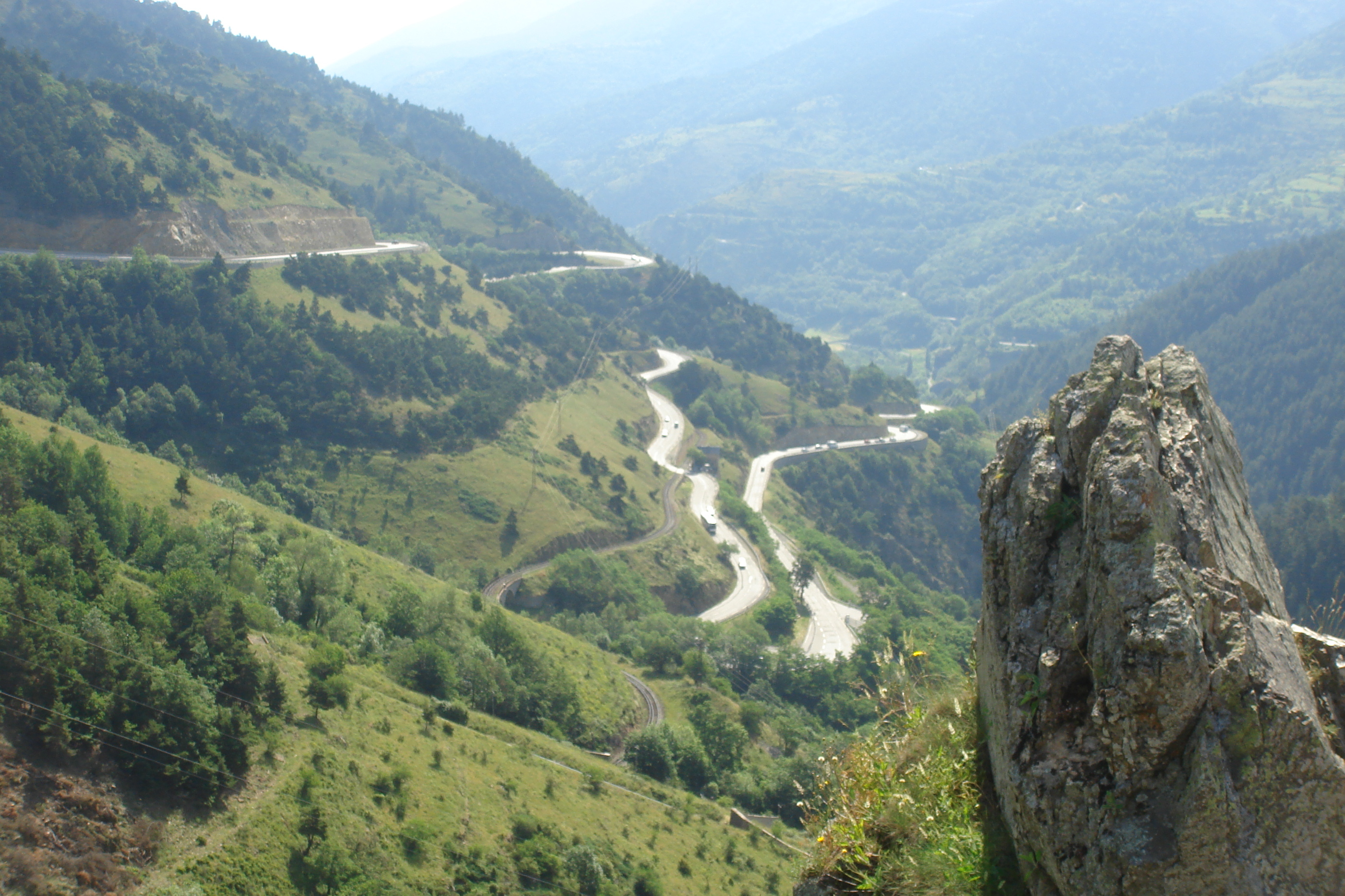
Looking over the run in towards Sestriere in the middle right distance

Then to #16 I was too low crossing the streams and nothing quite fitted so after some dithering decided to climb up the hill and hit the track to see where I was. Fortunately I saw the very large rock, relocated and made my way carefully down by the stream. At least another 3mins lost!

OLYMPUS DIGITAL CAMERA

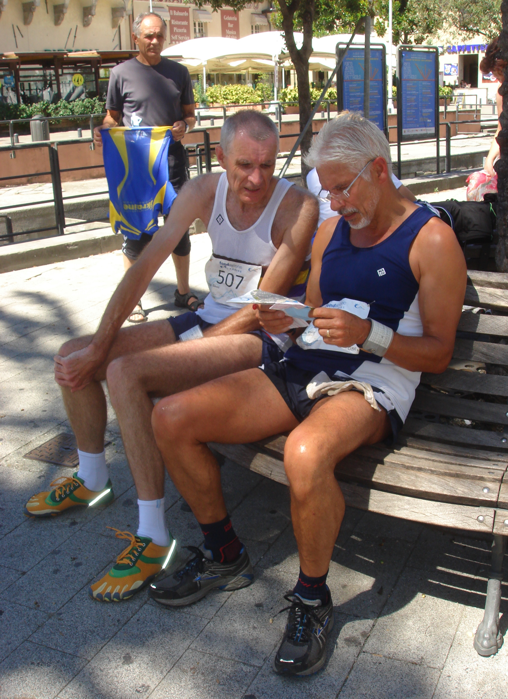
Mikhail Gryaznevich (TVOC) and James Crawford (GO) comparing times at the finish

Slightly disheartened I slogged up the steep slope from #16 to the track and then went fast through the last 4 controls and into the finish arena with no problems.

Despite the errors towards the end I really enjoyed the course and my run and realised what I could do, and how fast I could actually go, if I kept it all together. I finished 34th overall which is actually my best WMOC Long Final result out of the four I have done so far – but I knew how much better it could quite easily have been.

Posted in Uncategorized | Leave a comment

World Masters Orienteering Championships – Sestriere – Italy – July 2013 – Day 3 and 4 Long Qualification

Long Qualification 1 & 2 – Sansicario: LQ1 – Alto – 5.6kms; 280m climb; 19 controls. LQ2 – Pariol – 5.7kms; 295m climb; 18 controls

OLYMPUS DIGITAL CAMERA

The steep wooded slope for the two qualification races. The 2006 Winter Olympic Bobsleigh course can be seen and its top section is also depicted on the LQ2 Map below. The Arena is left of centre.

Both of the Long Qualification races were based above Sansicario on steep forested and semi open grass land cut through by the occasional ski slope and lift. Both days also used the same Arena and Start with Day 1 to the north and Day 2 to the south. There was a long steep climb up to the start on both days, so the legs had a good workout, and a warm-up map enabled one to get familiar with the depiction of the terrain. I had an early start on Day 1 but much later on Day 2 which was fortuitous as the early rain had just about

LQ1 4

Arena for LQ1 & 2

cleared up – though it was very damp and I did suffer from some misting up of my glasses.

My plan was to be cautious and not run too fast to try to avoid making time costly mistakes. I figured two solid runs without significant mistakes would be sufficient to see me through to the A Final.

OLYMPUS DIGITAL CAMERA

LQ1 Map

No major issues on day one though the early steep uphill legs soon had me gasping for breath.

DSC06765

Typical terrain

Running along the slope was hard on the ankles and then the steep downhill legs required holding oneself back, grabbing hold of branches and breaking ones speed on the occasional tree trunk to avoid getting out of control – a couple of times I still went head over heels or slithered down the slippery grassy slopes on my backside.

LQ2 Map

LQ2 Map

Day 2 was very similar but two small lapses of concentration cost me a few minutes. I was running too fast towards the end of the leg to #6, hadn’t really planned or visualised the final approach and was tempted by another control on the small hilltop just outside the circle to the north. And I was then ultra cautious and slow getting away from #6 round the green and over the streams and finally off the path and on my way to #7.

DSC06760

The steep downhill to the run in

Then coming out of #14 I looked up and saw a rock face on my left and thought I should be running past it to get to #15 but instead was heading SW and along and indistinct path on the side of the slope. A quick check of the compass brought me to my senses when I realised I was running in the wrong direction and I cursed myself for a very silly mistake.

I then got to grips with the map, properly interpreted the terrain again and the position of the rocks and cliffs on the other side of the slope. As you can imagine I then tried to put on a spurt of speed which was difficult of the side of the hill to #16 but was easier and essential for the later part of the leg to #17 which I took to the east of the pond.

LQ1 2

On the run in on LQ1

Strangely both days had a relatively long (as a percentage of the entire course length) and navigationally un-challenging penultimate leg which seemed a bit of a shame to me. Maybe cutting out one or two earlier controls and putting extra ones at the end would have made the

DSC06781

Chatting with Jean Velecky (SOC W90) after our runs. There was only one other W90 competitor, two M90’s & one M95

courses even more challenging throughout.

At least I had achieved my main aim and got through to the A Final, albeit in 63rd place. I would be starting the final just 1min before Mikhail Gryaznevich from TVOC.

Posted in Uncategorized | Leave a comment

World Masters Orienteering Championships – Sestriere – Italy – July 2013 – Day 2 Sprint Final

Sprint A Final – Sestriere – 2.4kms; 60m climb; 17 control

Me Warming up at Sestriere Sprint Final

Warming up at Sestriere Sprint Final – the start was just to the right

Another splendid arena and run-in in the main shopping precinct of Sestriere. And a good course too – very compact and with constant changes of direction. However there was quite a significant climb mostly on grassy banks and one huge unavoidable drop into #4 that I finished up doing backwards scrabbling with my hands in what grass was left to slow my descent.


Sestriere Sprint Final 6

The finish arena in the shopping precinct of Sestriere

The overwhelming limiting issue for me was simply not being able to run fast enough primarily due to a shortage of breath rather than weary legs. Maybe not long enough acclimatising to the altitude – or maybe not enough training generally.

However there was no real excuse for two or three suspect route choices. The most significant being to #15 where I hadn’t fully recognised the importance of the control description and made my final approach from the SW which involved an unnecessary loop round a building costing me at least 45secs.OLYMPUS DIGITAL CAMERA

That plus another couple of route choice issues and the shortness of breath left me somewhat adrift at 20th – 2min 41secs behind the winner Francesco Guglielmetti (SUI) and 1min 49secs behind James Crawford (GO) in 6th and 1min 22secs behind Gavin Clegg (WSX) in 8th.

DSC06639

My control 8 where I ducked through the fencing only to come back again when I realised there wasn’t a way through in that direction

No excuse I know but I did struggle with the steep, and often grassy, slopes and would have preferred a flatter course. But you have to be able to tackle whatever the terrain and the planner throws at you so  absolutely no excuse. More concentration, focus and harder training and commitment is what is required.

WMOC Sprint Final Sestriere 346Roll on 2015 and my first year as an M60. I shouldn’t really say that but maybe it is a sensible target for me to really focus on in the longer term to achieve my ambition to get on a WMOC podium – all or nothing planning and training for the next two years leading up to a massive assault on all major 2015 orienteering competitions – and then take up another sport such as sailing perhaps before the legs give up completely!

DSC06657

British Podiums – Nick Barrable 3rd M35; Sarah Rollins 1st W35; Bill Hanley 3rd M60; Tony Thornley 3rd M65

On the brighter side I did after all just make the top 20 and slightly improved on my 27th in the qualifier. Fantastic also to see several Brits on the podium again this year.

Really looking forward to the long distance qualifiers in the mountains now after a day of rest tomorrow probably cycling into the Troncea valley which is supposed to be beautiful.

Posted in Uncategorized | Leave a comment

World Masters Orienteering Championships – Sestriere – Italy – July 2013 – Day 1 Sprint Qualification

DSC06453

Centred on Sestriere (altitude of 2035m) and the surrounding mountains that hosted the 2006 Winter Olympic Games this seemed like a perfect setting for WMOC 2013. And it was too. The alpine climate was perfect with clear blue skies, a hot sun and cooling mountain air.

DSC07059

The magnificent setting of Sestriere

The organisers said this WMOC set a record for the largest number of countries represented – 45. However the total number of competitors was down with only 2603 entered for the WMOC. Finland had the largest contingent with 528 followed by Norway with 382 then Russia and Sweden. GB had 64 and surprisingly Italy, the host nation, only had 35. As a result of the lower numbers M55’s were split into 3 heats rather than the 4 in previous years.

Sprint Qualification – Pragelato – 1.9kms; 55m climb; 18 controls

DSC06616

Arena at the base of the Olympic ski jumps

Access couldn’t have been easier as we were camping on the outskirts of the town at Villaggio GoFree so cycled in. And what a splendid arena at the bottom of the Olympic Ski Jumps. Looking up those I’m glad I chose a sport that keeps you in contact with the ground.

DSC06449

Pragelato nestled in the valley

It was already very hot jogging out to for my start at 10:24.

Pragelato is quite a thin linear town on either side of the main road down the valley. As a result nearly all courses visited the grassy & forested areas surrounding the town on the valley sides as well as the older streets plus a timed crossing over the main road between controls 7 and 8 on my course.

DSC06540

The compact old town area wher controls 5 to 8 were positioned

My start was a little manic and before I knew it I had run well beyond my first control. I was also slightly confused by the control description symbol which was a circle and mis-interpreted it for a hill-top when there was a control on a small hill-top in front of me. Ran back to the correct control which was actually a bench / table. 1min lost already and I’d hardly even started my WMOC2013 campaign.

DSC06627

The exit from the busy market

OLYMPUS DIGITAL CAMERAKnuckle down, concentrate and keep moving fast – I told myself. And that’s pretty much what I achieved. No further mistakes and was well and truly out of breath at the finish. The course through the town was tight, twisty and fun though not without incident. At one point I was blocked by cars squeezing past each other and a parked car on a backstreet to #5, had to dodge shoppers in a busy market coming out of #8 and then nearly swept a lady off her feet on a small footpath leaving #9.

Once out of the narrow streets and across the river bridge, there was quite a long straightish run taking in 4 easy controls through fields and a gravel track to the run-in.

DSC06610

Comparing times with Gavin Clegg (WSX)

A bit of an anxious wait to find out if I had done enough to overcome the early error and get into the A Final – which I did being 9th in my heat. Phew! Not as bad as I thought it might have been. Effectively 27th in the class across all three heats. Gavin Clegg (WSX) won our heat and without my little indescretion I would only have been seconds behind him instead of 1min 19secs.

Have I done myself a favour perhaps ? as I shouldn’t be under so much pressure as if I’d got into the top 10 for the reverse order start of the final – we’ll see tomorrow.

Posted in Uncategorized | Leave a comment

5 days of Apennines – 27th July to 1st August 2013

LogoMy first time orienteering in Italy and as this area is a bit special for me I was really looking forward to it. However, as the World Masters followed on so quickly I decided to only run on the first three days of the five rather than wear myself out, risk injury etc.

Cugu Du Rizzo - Casa Del Romano - Pannorama

The event was based in the Alta Val Trebbia www.altavaltrebbia.net around Rovegno an hour’s drive up into the Ligurian hills above Genoa. We stayed at Camping le Fontanelle www.campeggiofontanelle.it It was a beautiful and simple site but was full to bursting with the influx of orienteers in addition to the usual summer visitors.

The adjacent La Tarverna www.latavernavaltrebbia.com provided good food and also the excellent local, but expensive (6Euro a bottle), Trebbia Beer made with chestnuts that abound in the forested hills.

Day 1 – Fonte del Galletto nr Rovegno – 3.4km; 165m climb; 14 controls

OLYMPUS DIGITAL CAMERAThe terrain consisted mostly of steeply wooded slopes with a mixture of light and thicker vegetation, included a patch of rocky glacial moraine and ended in open fields.

I was very careful to pick up one and two and settle into the map. When I found the exit from #2 very rough and slow I decided that I would take the track and smaller path as far as I could and then head off down the re-entrant to #3.

I went direct to #5 which was slow going but was pleased, at the time, how well I found the control amongst the rocks. In retrospect maybe the path route could have been quicker and would have helped me avoid the mistake that was to follow. Unfortunately I didn’t pay enough attention on leaving #5, crossed the river and thought I was on the little path leading to a bigger one – but I wasn’t and took some time to work out what I’d done so lost several minutes.

Day 2 – Casa del Romano – 4.3km; 170m climb; 16 controls

Had a lift with Gavin Clegg today in his Porsche Boxter which was the ideal way to get to the event along the extremely twisty little road up from the valley to the heights of Casa del Romano.

The terrain here was mostly open grassy pasture on a very steep hill side cut through with many beech filled deep valleys.

OLYMPUS DIGITAL CAMERAI stayed on the top of the hill and path as long as possible and dropped down to #1 which worked well. #2, 3 & 4 were good too. Went too straight towards #5 and had to work my way up the valley to where the 4 streams became one before I could cross then went up to the track and back down into the control.

Left #5 and reached the track to cross the next valley and streams. I looked down at my map here and mistook my position thinking I was back half way between #4 & #5 and began navigating to #5 again. Absolutely stupid I know but at the time it was what I thought I should be doing and the path I was on seemed to be going in the right direction. Before I knew it I can now see I was well off the map and took ages to realise what I’d done.

The remainder of the course went well even though I was naturally a little disappointed.

Day 3 – Genoa Urban Race – 3.8km; 20 controls

DSC06165

Time for a coffee on the way to the start

DSC06166

The old port setting for the assembly & finish

The event centre and finish was in the Port Antico with its wide open pedestrianised spaces. The start was very central and the route took us mostly through the streets of the medieval old town which is characterised by narrow alleys deep in shade under the tall buildings that seemed to be leaning to meet each other at their eaves.

OLYMPUS DIGITAL CAMERAI took a slightly longer route to #1 than I should have when it looked to me like a closed gate was blocking my first choice. Had to steady myself towards #2 to check the best approach. Through to #7 I tried to choose the simplest routes, concentrating on the turns and executing well, but still overshot #5. Then turned too early for #7 losing precious seconds. Somewhere between #9 to #11 the route took us through the red light district which was a surprise for us and the girls touting for business – no time to stop though!

DSC06188

Comparing route choices with Gavin Clegg

Unfortunately yet another silly little error slightly marred the end result when I ran straight past and forgot to punch #12. The reason was probably the heavy traffic I encountered and the dodging between cars as I approached #12 from the south and was already planning my route to 13. I didn’t realise my error at the time and kept going as fast as I could through the remainder of the course only to be told I had missed a control when at download.

Despite the result I was pleased with my speed, thought it was a terrific course which was challenging from the off and kept you on your toes all the time and I really enjoyed it.

After the event we took the coast road past Camogli and on to Portofino for a walk out to the lighthouse and a late swim below Castello Brown.

Posted in Uncategorized | Leave a comment

Tramontane ‘O’ 5 Days of France – 13 to 18th July 2013

DSC05940a logo1,715 competitors in all with 711 French, 417 from Norway, 240 from Spain, 99 from GB and there were 68 in my M55 class

The first 3 days were in the high Pyrenees based at Font Romeu at 2,000m where the terrain was mostly runnable forest, with some open and semi-open areas. The biggest hazard might well be the effects of altitude as the areas are at around 1700 to 2000 metres above sea level. This should also help me acclimatise for the forthcoming Word Masters in August which takes place in the alpine terrain around Sestriere, Italy at an altitude of 2035m. Here in the Pyrenees we stayed at Camping du Lac Matemale http://www.camping-lac-matemale.com which had the luxury benefit of a sauna and hot tub which I used a couple of times.

DSC05920

An evening meal at La Pinada campsite – still very hot at sunset

The last two days, after a day of rest and transition, were in the lowlands to the west of Narbonne where we stayed at Camping Pinada at Villerouge-la-Cremade http://www.camping-le-pinada.com which had a fun atmosphere and inviting pool which was very welcome in the high temperatures. Moving down to the Narbonne area not only meant a significant rise in temperature but also a complete change in terrain and vegetation which now included some very tough undergrowth indeed. One of the more challenging was the Kermes Oak which is a low-growing, evergreen oak with very spiky leaves – ouch!

Day 1 Bolquere / Barres – 3.7km; 160m climb; 15 controls
A middle distance event to get the competition under way. A walk uphill through the ski chalets to the start then off through #1 and #2 which were fine, but I mistook my position crossing the last path before #3. Thinking I was further south than I actually was meant that I missed the control by some distance and took quite a while to realise my mistake and re-locate. #4 to #9 went well but a lot of undergrowth and brashings made the leg to 5 Days of France - Day 1 - Bolquere &  Barres (large)

#10 very difficult and slow and I actually located the control only after relocating in sight of the buildings. Then ran too fast trying to make up time and was a little disorientated coming out of the road underpass and started off in the wrong direction for #12. It was then fast to the finish on the edge of the town. 12th in class could have been a little better perhaps.

Day 2 Les Airelles – 5.7km; 180m climb; 12 controls
5 Days of France - Day 2An anti clockwise route around the ski station with the two long legs 5 – 7 crossing several, now grassy, pistes. Cautious to #1 as I got used to the terrain so hit & used the track until the sharp left hand bend, then cut right downhill to follow the stream to the control. Hard work uphill through #2 to #4 and then the veg opened up. After crossing the road I followed the track to the piste and then the stream up to #6. To #7 was flat out ticking of features until crossing the next 5 Days of France - Day 2 - Les Airelles (large)road & then following and counting off the broken banks / walls to #8. Traversing the valley to #9 and dropping down the hill to #10 were both quite hard work before speeding up towards #11 until hitting the rocky hill top followed by a nice downhill finish. 10th in class was ok.

Day 3 La Quillane – 5.7km; 220m climb; 13 controls
5 Days of France - Day 3 - La Quillane (large)Oh dear, not so good today as I didn’t hit #5 first time and spent ages re-locating as I just couldn’t match the veg on the ground to the map. From #4 I used the cleared ground along the pylon line to cross the marsh then headed south through the open forest with the thick veg on my left which I intended to cross at the 5 Days of France - Day 3 Finishnext marsh then into the control. Seemed doable, but it all got very thick, & extremely slow going and ultimately confusing towards the end. There was some nice runnable terrain to follow, but also some more muscle sapping marshes to cross, probably not helped by some of my route choices. The end result was 31st today and a tired, exhausted and disenchanted body.

DSC05471A day of rest and transition down to the lowlands followed taking it slowly with the caravan through the hairpins. Stopped for a pickup at Perpignan airport as Catrin, my wife, was returning from a few days in the UK where she had been to a Rolling Stones concert in Hyde Park.

Day 4 Conilhac-Montbrun – 5.3km; 85m climb; 16 controls
5 Days of France - Day 4 Start Area5 Days of France - Day 4 - Conilhac-Montbrun (large 2)Quite a long walk to the start on the top of the plateau from where there were some splendid views of the surrounding countryside and many vineyards. Not a good start as I run into the wrong valley to #1 but pleased with navigation through 2-3-4. Then there’s the longest leg of the day which has some interesting variation of terrain along the way. However there is only one logical crossing point of a river ravine which helps focus planning and I choose the dry valley up to #5 after DSC05091crossing the second smaller river. I was a little anxious about #6 & #7 but they turned out ok then I stayed high to #8 and around the DSC05098aveg to #9 then zig zagged to #10 and downhill through the final controls to take us into the run-in to the finish. And what a welcome reception it was to be presented with a bottle of local red wine when passing through download. 10th today felt good and I was happy with that.

Day 5 La Campane – 3.3km; 140m; 14 controls
5 Days of France - Day 5 - La Campagne (large)A shorter course today which looked like it would be quite fast but the terrain deserved rather more respect that I gave it. #1 was ok, but my plan of approach to #2 changed as I approached the 5 Days of France - Day 5 cliffssteep drop off the plateau and then I went too low and wasted time traversing to and fro along the slope. Then finding #3 also proved quite a challenge and I went too low again. The remainder of the course went reasonably but I’d already lost too much time for a good result and finished a distant 26th.

DSC05218We stayed on in the area for a few extra days and thoroughly enjoyed exploring the area, visiting Carcassone, Narbonne and local towns & villages and stumbling on a music festival in the quaint cobbled village of Lagrasse. There was some lovely walking and cycling along the Canal du Midi and more strenuous cycling off-road through vineyard covered Corbieres countryside.

Posted in Uncategorized | Leave a comment

Portugal 2013

Three events (12 races in total, 3 Long, 5 Middle and 4 Urban Sprints) in the space of three weeks and all within relatively easy reach of each other in central Portugal was an opportunity to good to miss – especially to swap the freezing GB winter for the milder Portuguese climate.

Lake by our campsiteI had hoped to arrive in the vicinity with a few days to settle in and acclimatise, but unfortunately our ferry from Portsmouth to Bilbao was twice postponed due to storms in the Bay of Biscay. So it wasn’t until the evening before the first event that we arrived at our campsite by a lake (Barragem Marechal Carmona) 5 miles from Idanha-a-Nova and not far from the Spanish border – a very quiet corner of Portugal.

Norte Alentejano O’Meeting (NAOM) based around Nisa

NAOM Logo 1According to the event website this was the “7th consecutive year this event had run and the first time it had returned to Nisa, where it all started in 2007”.

Day 1 – Arez – Middle Distance – 4.1km; 80m climb; 20 controls; 1:10k map

Day 1 Arez route to the startBased at the old bull ring in the small village of Arez the influx of orienteers of many nationalities brought the place to life. The terrain was rough open land with scattered olive trees and many large boulders and outcrops of rock.

OLYMPUS DIGITAL CAMERAMy course was compact comprising mostly short legs and with a footbridge river crossing to get from one part of the map to the other. It was straight in the deep end having to navigate through the boulders to #1 and I got pushed out quite a long way to the right by the very thick dark green veg so went right round the outside.

Footbridge crossing Day 1 ArezCautious to #2 threading my way through all the boulders then into a good rhythm for the next few. I didn’t actually spot the marked crossing of the river from 8-9 so forded it thigh high and then I had trouble finding #9 until I came across another control in one of the wet pits to the north. Cleaning up after Day 1 Arez with homecooked O food about to be consumedThe last section after the footbridge was fast and furious and I overshot #19 and had to check myself and look back. With the two or three little errors I was surprised to find I was first by 55 seconds. Washed down and cleaned up after the event and filled up with a bowl of home cooked o food.

Day 2 – Lapa – Middle Distance – 3.8km; 80m climb; 15 controls; 1:10k map

OLYMPUS DIGITAL CAMERACool control featureWent too far left to #1 and struggled to identify     mapped features on the ground in the high broom like veg. Decided to follow precise bearing to #2 which worked better as demonstrated by a fastest split. Typical Day 2 terrain at LapaWent through too much bog staying straight to #3. To #5 took the right hand path to the gap in the wall then slowed right down so not to overshoot. Next few legs were good and subsequently saw from the splits that I went 1st at #8 where I stayed to the end finishing 2min 49secs ahead.

NAOM 2013 M&W55 PodiumMedal & Wine PrizeOverall for the two days I was 1st by more than 5 mins which was quite a pleasant surprise, as was the goody bag which included a delicious jar of tapenade and a bottle of local Termas de Nisa red wine to celebrate afterwards!

Nisa – Night Sprint – 2.3km; 1:4000 map

This was on the night of Day 1 so we stayed around NisaNisa after the run at Arez and eventually chose a café for a bite to eat – but hadn’t expected the food to take quite so long so was a little heavy in the stomach area for the subsequent run around the town! Despite this I had a good run and only really lost time getting orientated on the firstOLYMPUS DIGITAL CAMERA leg and then also towards the end when I took the 1st instead of 2nd turning right to #10. It was very enjoyable running through the narrow streets of Nisa and I finished 2nd.

All in all a very satisfactory start to the 2013 Portuguese campaign I thought, but unfortunately things went downhill a bit from here…..

Posted in Uncategorized | Leave a comment

6 Days of Austria – Wiener Neustadt – Austria – July 2011

Campsite grass scythingWe chose to use the ‘pop-up’ event campsite which was run by the local fire brigade. It was quite basic but adequate and I borrowed a scythe to cut back the long grass around our awning.

Austrian Event Campsite Washing Facilities

Campsite Washing-Up Facilities

Getting there early we were able to get a good spot within electricity hook-up range. There were several familiar faces from Hungary a week ago and we were again camped next to the Swiss orienteering couple Hanspeter & Brigit Oswald.

Looking back I guess I was just a little too wound up and tense for the World Masters in Hungary so I planned to be much more chilled for these few days in Austria. Finding a fantastic swimming pool in the town with a relaxing health suite with sauna, steam room, cold plunge pools etc also helped

I was the only British runner out of 40 in the M55 class though there were quite a few Brits in other classes.

Day 1 – Aspang – Middle 3.8km; 110m climb; 14 controls 1:7,500 & 1;4,000 maps

Aspang Day 1 Map

RouteGadget Map at 1:7,500

An unusual map – two sided at two different scales. Starting at 1:7,500, up through a hilly, coniferous wooded area with steep slopes.

Dual Scale Map

Change of scale at control 7

Then onto 1:4,000, for a more complex contoured area of gullies and steeply down hill to the finish. Making sure of the navigation to ensure no mistakes, which felt good, but probably a little slower pace as a result. The first leg was very long with only one obvious route along a contour hugging track before a short steep assent to the control. Several further legs took us up and over the hill then it was into the more intricate terrain which went well. Lost it a bit (2min) on the last two legs through poor route choice and finished 4th (36:45min) –  6min downAustria 6 Days Day 1 Assembly & Finish on the leader Anssi Juutilainen (Finland), 3mins behind 2nd placed Mario Ammann (Switzerland) and 38secs behind 3rd place Josef Hones (Austria). Afterwards it was lovely to be able to jump in the outdoor swimming pool just under the railway viaduct from assembly.

Day 2 – St Corona – Long 4.3km; 110m climb; 15 controls; 1:10,000 map

St Corona Ski Lift

View down piste to finish at St Corona

View down the piste to finish

This day was in alpine terrain and required a chairlift up to the assembly (a first for me at an orienteering event) and we chose to walk back down afterwards.

The course took us through some mixed forest, scrub and open terrain finishing with a steep downhill which crossed then descended on the now grassy piste.

Running down piste to finish at St Corona

Running down piste to finish at St Corona

St Corona Map

St Corona Day 2 Map

Started a little slow getting to grips with the detail on the map but then got into my stride with only one serious hiccup stopping to look for #8 too early in very tall grass.

The top four were the same as day 1 but in a different order. I finished 3rd 48 secs ahead of Mario & Josef was 1st this time and Anssi 2nd.

Day 3 – Wiener Neustadt – Middle 4.5km; 0m climb; 22 controls; 1:5,000 map

OLYMPUS DIGITAL CAMERA

Mario Armmann finishing day 3

Just a stone’s throw from the town this was a very flat military training area with scattered ruins and depressions started in an open pine forest then out onto grass / scrub land. It felt familiar being much like many of the flatter BAOC Military League South venues back home. It was fast and furious with 22 controls in 4.5km and you just couldn’t let your concentration lapse as seconds would count. Coming out of the forest into the intricate #4, 5 & 6 was difficult to adapt to but then I climbed up to 1st by #12 and kept it until #20 where I lost 30secs somehow homing in on the right depression. Terrain and format definitely suited me and I finished 2nd only 13 secs behind Anssi and 22 secs ahead of Mario.

Day 4 – Grimmenstein – Long 5.1km; 250m climb; 19 controls; 1:7,500 map

DSC_0054

Impressive Start Facilities in the Forest on Day 4

Today’s course took us around the 750m Kulmriegel mountain and required a shuttle bus to the start. Wow what a nasty first leg – straight up an 80m climb then some longer open forest legs led round the mountain to its steep northern side riddled with large cliffs and boulders.

Austrian O Food

Austrian ‘O’ Food

Mario, who started 2min behind me caught me up and overtook here and I was struggling to keep up. This egging eachother on caused us to both overshoot #11 hitting #12 first – silly! Mario gradually disappeared as we started the long descent which was taking it out of me and I was already feeling tired with quite some way to go when we got to a road crossing to #16. I found it a bit of a slow slog along the side of the hill to 18 and almost staggered down to the finish. I was 6th whilst Anssi was 1st, Mario 2nd and Josef 3rd.

Day 5 – Bad Fischau – Middle 3.8km; 105m; 17 controls; 1:7,500 map

OLYMPUS DIGITAL CAMERA

Tim & Carol Sands with Andy Hempstead & a Solway Sister

Going well up to #4 then struggled through vegetation and slopes to #5. #6 was ok but lost it completely to #7. I was always expecting to see a fenced compound to my left but never did and then completely lost my orientation until I was near the road and lost 6min on this one leg – what a disaster. The rest of the course was up and down then but I did, funnily enough, manage fastest immediately to #8 and somehow also on the run-in but to avail. Worst day by far finishing 10th with Anssi 1st again, Josef 7th and Mario 35th !

Day 6 – Witzelsberg – Long Chase 5.3km; 260m climb; 19 controls; 1:7,500 map

OLYMPUS DIGITAL CAMERA

Final day finish and arena

Dropping my day 5 score left me 3rd going into this final day chasing start. I started 4min 8sec behind Mario which would probably need an error on his part for me to catch him. I then had a gap of more than 5min to the 4th place starter so mustn’t make any big mistakes myself or my podium place will be in jeopardy! Really enjoyed the course which had quite a lot of variety and was complex and tricky in places requiring concentration and good planning and execution. This only fell down once going to #9 where I probably lost a couple of minutes after mistaking a minor path of to the left.

Brigit Oswald (OLK Piz Hasi - Swiss) W60 Champ

With Brigit Oswald W60 Champ

M&W55 Podium

M&W55 Podium

In the end I finished 2nd on the day just under 5 min behind Anssi, but I gained 9 secs on Mario. Overall for the six days Anssi Jutilainen was 1st (way ahead) Mario Amman was 2nd and I was 3min 59secs behind him in 3rd. My first top three position at a foreign event which I was very pleased with. The podium ceremony was backed up with some rousing fanfare music (have look at the amateur video)

Posted in Uncategorized | Leave a comment

World Masters Orienteering Championships – Pecs – Hungary – July 2011

Sprint Qualification – Pecs – 2.3kms; 105m climb; 14 controlsPecs Assembly Flag

WMOC 2011 LogoThe sprint qualification took place within the old city walls of Pecs with the assembly area and finish in the main Szechenyi Square with its wide open spaces, important buildings, Turkish mosque, statues and fountains.

Pecs Assembly Area & Finish Round Mosque

My course took me through the NE quadrant and its many interesting historical areas. My first control was in the ruined walls of a chapel that was built on top of an ancient Christian mausoleum. I then crossed in front of the Cathedral, went in and out of the city walls, through streets, inner courtyards and gardens and round the mosque to finish.

WMOC 2011 Hungary Sprint Qualification

Final control which is re-used each day

Sprint Qualification Map PecsThere was a very light shower as I started which left the hard surfaces damp and slightly slippery which I had to factor in during my run. My route choice was generally good though erring on the cautious side when finding it difficult to spot gaps whilst reading the map at speed. I was probably fortunate not to lose much time going to 6 when finding it was actually on the E side of an impassable wall whilst I was was aiming for the bottom of the steps on the W side. And I could have saved a few seconds from 8 to 9 by going through the inner courtyards rather than round the outside.

Orienteering FoodVery pleased to finish 2nd in my heat, 6th out of all four heats for my class and safely through to the A final. GB did well with six of us in the top 10 in my class so very buoyant looking forward to the Final. Rounded of the day with a fantastic Hungarian ‘snack’ after the race.

Sprint Final – Komlo – 1.8km; 60m climb; 11 controls

The modern mining town of Komlo provided Sprint Final Map Komlovery different terrain from the old town of Pecs. Modern buildings and many blocks of flats set on hillsides in an open plan style with grass, parks and small wooded areas between them. The main road had been cordoned off for the run-in and the small town seemed overwhelmed with the volume of people and an event of this size.

WMOC2012 Komlo Sprint Finish 1The seeding found me starting 2nd to last with James WMOC2012 Komlo Sprint FinishCrawford (GO) behind so I didn’t want to see him coming up behind during the race. With such a short course (1.8km), not much climb, but a lot of downhill, I knew I needed to be running flat out right from the start whilst keeping it smooth through the controls. And it went mostly as planned!

First major route choice was 3 to 4 and I decided to take the eastern route up the steep hill path through the olive green. 5 through 6 & 7 and most of the way to 8 was all downhill and dangerously fast on the slopes with short cropped dusty grass.

DSC05922

Debrief with Mikhail and Gavin

At 6 my times reveal I was in 3rd place but then dropped back a bit. Could probably have chosen a slightly faster route to 8 and then it was into the intricate hillside park for the final legs. Thought I could see the Swiss who started 1min ahead of me, but lost all hope of keeping up with him when I misjudged 10 and flew past it too high up the hill losing about 20 precious seconds and dropping from 5th to 9thoverall.

Still very pleased to be in the top 10 and, having finished 18th last year, will be looking for a top 5 or podium next year!

Long Qualifications (LQ) and Final – Mecsek Mountains

Sink Hole Terrain

Typical karst sink hole terrain

The two qualification and final races all took place in typical karstic terrain above Orfu in the Mecsek Mountain forests NW of Pecs with its intriguing ‘negative’ terrain and  numerous sink holes – some being very large indeed. It was fun planning and especially executing routes through this terrain often running round the rims of the sink holes first one way then the other, feeling like one was being sucked in by the gravity of a black hole or gaining velocity like a spacecraft sling-shotting round a planet.

LQ1 started well including a fastest time to #2, but I lost far too much time at 7 & 8 and finished 18th. LQ2 was much better finishing 5th with 3 fastest legs at 3, 7 & 9 and only one significant hiccup at 14 dropping some 3-4 min. These gave me an overall 10th in my heat and safely into the A Final – for the first time at this my 2nd WMOC.

The day of the long final was very hot and despite drinking lots before the start I felt WMOC 2011 showerdehydrated within 15min. Started a bit slow, but increased speed and gained places to be 7th after  #12. On the way to #13 there was a drinks station on a track at the top of a steep rise and I took advantage of it to quench my thirst. Unfortunately this lead to a lapse in concentration and an immediate frustrating 5-6 min error. In the end I finished 37th and 4th Brit. Results here. When back in assembly it was wonderful to get under the cold water spray provided by  the local fire brigade.

Our stay in Hungary was at a very convenient campsite in Sikonda ¾ OLYMPUS DIGITAL CAMERAof the way between Pecs and Komlo. This was the Mediano Thermal Camping , which had a cute retro logo, just a short walk from the OLYMPUS DIGITAL CAMERAexcellent Sikonda Wellness Hotel & Thermal Baths which were excellent value and which we used a lot including the saunas and steam rooms and the 50m outdoor pool.

There was a coach load of Estonian orienteers staying in WMOC 2011 Winery music manchalets at the same campsite and the site owner invited us, and a Swiss orienteering couple Hanspeter & Brigit Oswald, to join them in his outing to the Blum Pince winery at Villanykovesd near Villany  We were treated to some very hearty Hungarian food, pitchers of local wine, some ‘rustic’ music and dance and a trip down into the cellars to sample more wine – all great fun.

This was the furthest East we had traveled in our caravan and orienteered and, though initially unsure what to expect, we found it delightful and also good value – which was a bonus. Would definitely go back to Hungary again.

Posted in Uncategorized | Leave a comment

JK Festival of Orienteering – Northern Ireland – 22nd to 25th April 2011

Sprint – Stranmillis University College & Queen’s Elms Village in Belfast
JK 2011 Logo

Having a very late start time – last off – I was able to fly from Cardiff to Belfast on the morning of the event and still have time to soak up the atmosphere and have a good pasta lunch in the canteen overlooking the Assembly, Start and Finish areas below.

The day had been fine but a light rain started shortly before my start which left some of the surfaces very slippery which might, ironically, have actually helped me as I had to run with special care and not always flat out!

The first half in Elms Village was made up of short legs and rapidly changing directions in and out of the mass of buildings. It wasn’t easy in the short distance and time between controls to plan any further ahead than the next control. As a result I hadn’t fully appreciated the position of 4 and had to stop and examine the map more carefully – then I was off again. The hard surfaces from 6 through to 9 were very slippery and required care when changing direction and then it was through the gap into the second half in the University grounds. I had earlier seen some of my fellow competitors running through the spectator control 13 and had also roughly noted some of their times to that point so calculated I was probably doing quite well in comparison.

JK Sprint Map 3

Running too fast I went straight past 15, not having read the control description – it was on the other side of the small building under the overhang! 16 to 20 went quite smoothly though was worried 20 wasn’t going to be as obvious as it looked on the map. Found the approach to 21 confusing as, on the ground, the gap between the wall and the building looked very narrow and the sight of a piece of red and white tape on the end of the wall convinced me to keep to the south. At the bend in the wall I glanced over it, saw my control below and had to go round the end and back down from the opposite direction – at least 15 precious secs lost.

OLYMPUS DIGITAL CAMERA

The finish arena

Went through the last four controls smoothly despite being unsure exactly what 23 might look like when I got there – it appeared like a maze on my wildly bobbing map! Then I was very surprised to be running into the finish straight with hardly anybody around rather than the excited bustle and commentary that I had witnessed earlier and was accompanied only by a lone guitarist singing and strumming * through the loudspeakers in the background,– but then I was one of the last to start! And looking at my splits printout after downloading I was so thrilled to see “you are currently 1st out of 91 finishers” knowing there was no-one else to come in. My first Gold at a major event and after my Bronze at the British Sprint earlier in the month I am getting the message that the Sprint format suits me.

The same M55’s took the top three places here as we didOLYMPUS DIGITAL CAMERA at the British Sprint championships, but this time I was 1st, 39secs ahead of James Crawford (GO) in 2nd with Gavin Clegg (WSX) 3rd. Unfortunately I had to wait until the next day for the prize giving at Tyrella and James & Gavin who had earlier runs were unable to join me on the podium.

*The singer / guitarist was Josh, the son of the organiser, and he was playing “My Lagan Flowing Softly“, originally by Bakerloo Station. The River Lagan rises near the summit of Slieve Croob (used on Day 3 of this JK) heading in a NW direction then winds its way 40 miles down to Belfast.

Posted in Uncategorized | Leave a comment